When people think limited mobility, they only think about people in wheelchairs. They often forget about Pregnant Women, Baby Strollers, People on Crutches, and the elderly.
When people need to know how to get to a location via public transit, their first instinct is Google Maps. Enter in your destination and you are presented with several options and routes via Bike, Walking, Public Transit. However, these routes don’t take into account one crucial thing. They are all meant for able-bodied people without any mobility limitations such as wheelchairs, baby strollers, crutches etc.
All of these factors whether temporary or permanent make it difficult to move around the city. The current alternatives for finding travel information for those with limited mobility are websites that are poorly designed and rely heavily on user generated updates.
Background
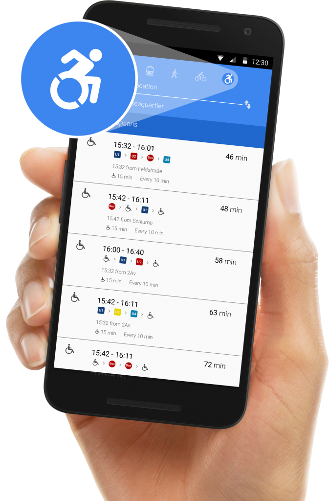
In Hamburg only about half of its U-Bahn stops are wheelchair accessible. Which means for those with limited mobility using Google Maps for transit directions is practically useless. Since 2018 Google Maps has added the Accessibility option to all of its listed locations to say whether or not any location can be accessed with a wheelchair.
Idea
By using this accessibility data for Public Transit, Google Maps will then be able to give accurate Public Transit options and times for the destinations of people with limited mobility. Just like everyone else. By creating another travel option on Google maps we make public transit easier and even more accessible (no pun intended).